- Provides political, shaded relief, historical, and thematic maps like population and vegetation of Peru.
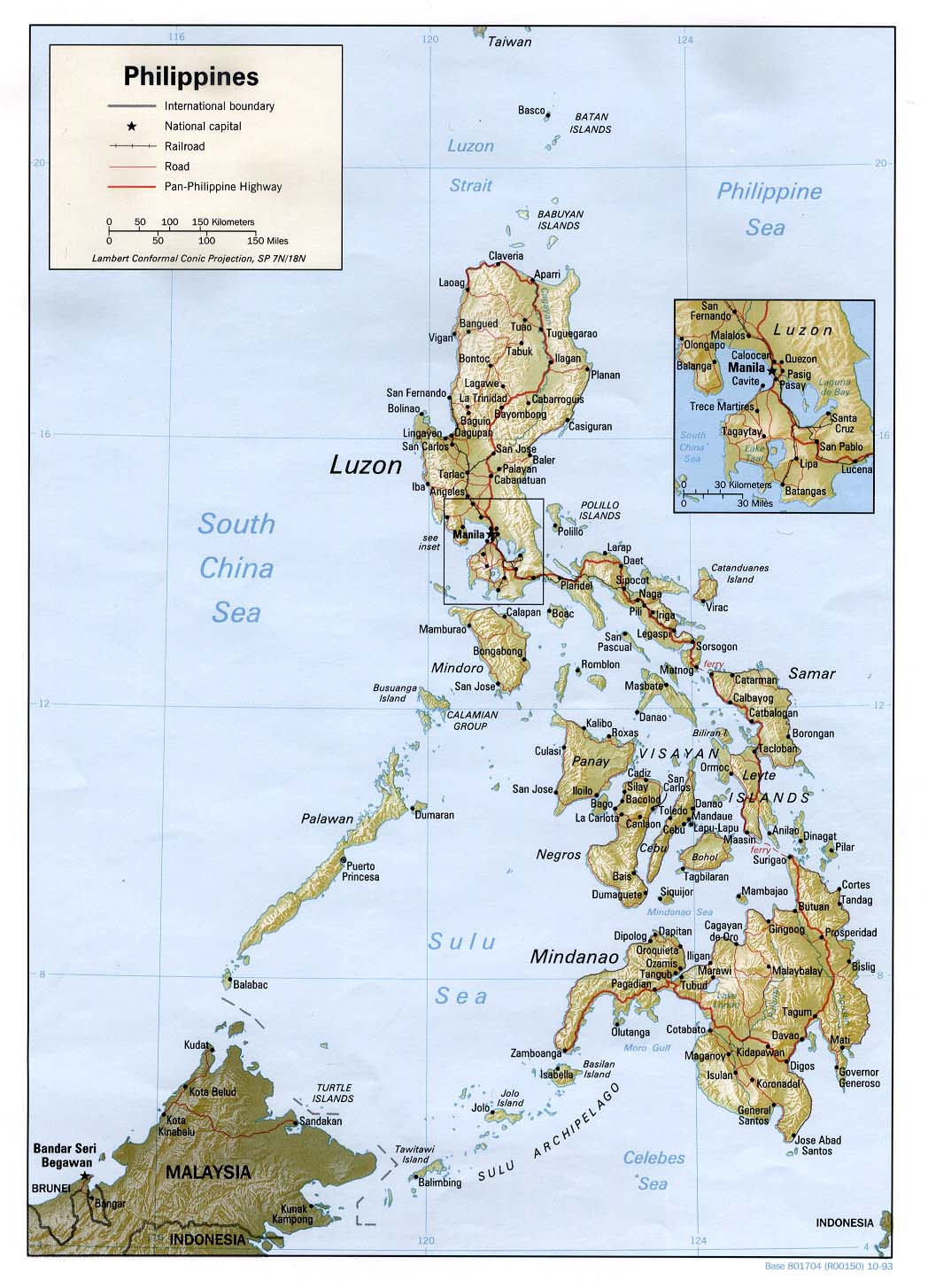
Philippines Map - Displays roads, railroads, and Pan-Philppine Highway.
Photohaven - A tour of Missouri through photographs.
Photoscenics in New Hampshire - A photographer's guide to finding the best New Hampshire scenic locations. Written by a long-time resident and photographer.
Pickatrail - Offers a variety of U.K. and U.S. trail maps. Also includes trail-side directional photos, GPS waypoints, information, and more.
Picture Michigan - Collection of photos from all over Michigan, plus relevant statewide links.
Pikes Peak Cam - Live picture of world famous Pikes Peak from the top of the Softronics Corporate Headquarters in Colorado Springs, CO.
Placeopedia - Online application allowing you to connect Wikipedia articles with places, and then use the geographic database to browse or syndicate articles by the locations they describe.
Planet Observer - Provides earth satellite pictures and images, real time planet navigation, and information on image processing and different types of existing satellites.
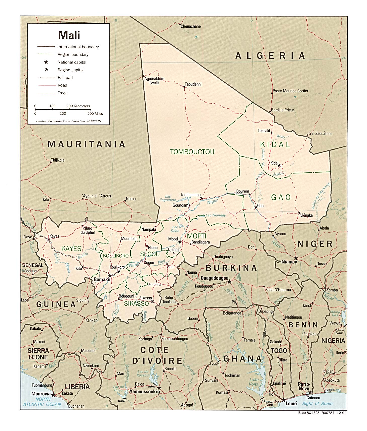
Political Map of Mali - </li></ul></div></td></tr><tr><td height="5"><spacer type="block" width="1" height="1"></td></tr></table><table width="100%" border="0" cellspacing="0" cellpadding="2"><tr><td colspan="2"><span class=headers>href=http://www.lib.utexas.edu/maps/africa/mali_pol94.jpg>Political Map of Mali</a>
Political Map of Niger - </li></ul></div></td></tr><tr><td height="5"><spacer type="block" width="1" height="1"></td></tr></table><table width="100%" border="0" cellspacing="0" cellpadding="2"><tr><td colspan="2"><span class=headers>href=http://www.lib.utexas.edu/Libs/PCL/Map_collection/africa/niger.jpg>Political Map of Niger</a>
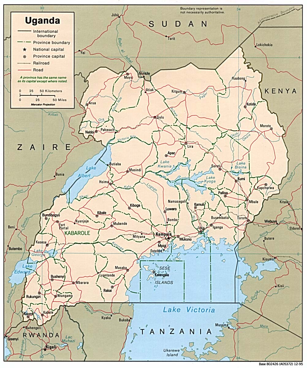
Political Map of Uganda - </li></ul></div></td></tr><tr><td height="5"><spacer type="block" width="1" height="1"></td></tr></table><table width="100%" border="0" cellspacing="0" cellpadding="2"><tr><td colspan="2"><span class=headers>href=http://www.lib.utexas.edu/maps/africa/uganda_pol95.jpg>Political Map of Uganda</a>
Quad Cities USA WebCam - Information and photo archives of Moline & Rock Island Illinois, Davenport & Bettendorf Iowa and surrounding areas.
Quick Maps of the World - Offering small GIF maps of the countries of the world sorted alphabetically for quick reference.
Readio New York - Features daily New York City photo tours, a daily updated soap opera with NYC photos, restaurants, Broadway pictures, hotels, museums, clubs, and recipes.
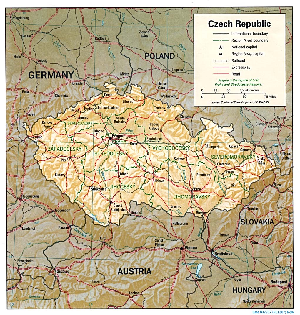
Regional Map of the Czech Republic - </li></ul></div></td></tr><tr><td height="5"><spacer type="block" width="1" height="1"></td></tr></table><table width="100%" border="0" cellspacing="0" cellpadding="2"><tr><td colspan="2"><span class=headers>href=http://www.lib.utexas.edu/maps/europe/czech_rel94.jpg>Regional Map of the Czech Republic</a>
Regions of France - Offers physical, political, and road maps of France.
Relief Map of Nigeria - </li></ul></div></td></tr><tr><td height="5"><spacer type="block" width="1" height="1"></td></tr></table><table width="100%" border="0" cellspacing="0" cellpadding="2"><tr><td colspan="2"><span class=headers>href=http://www.lib.utexas.edu/maps/africa/nigeria.gif>Relief Map of Nigeria</a>
Relief Map of Togo - </li></ul></div></td></tr><tr><td height="5"><spacer type="block" width="1" height="1"></td></tr></table><table width="100%" border="0" cellspacing="0" cellpadding="2"><tr><td colspan="2"><span class=headers>href=http://www.lib.utexas.edu/maps/africa/togo.gif>Relief Map of Togo</a>
Relief Map of Zimbabwe - </li></ul></div></td></tr><tr><td height="5"><spacer type="block" width="1" height="1"></td></tr></table><table width="100%" border="0" cellspacing="0" cellpadding="2"><tr><td colspan="2"><span class=headers>href=http://www.lib.utexas.edu/maps/africa/zimbabwe.gif>Relief Map of Zimbabwe</a>
ReliefWeb Map Centre - Includes unique maps reflecting humanitarian emergency situations, actors, and resources worldwide.
ReliefWeb: Iraq Maps - Features a variety of Iraq maps, including satellite imagery.
South Carolina County Map - Features a hyperlinked, printable map of the counties of South Carolina, with population and geographic statistical information. Provided by the US Census Bureau.


