Links:
- A9.com Maps - Colorful maps from Amazon.com, featuring actual block view images.
- ABC Maps of Haiti - Provides maps of Haiti.
- About.com: Hungary Geography, Maps, and Information - Offers links.
- Active Map of Finland - Map of Finland. Includes also links to Finnish cities and municipalities and road distances in Finland.
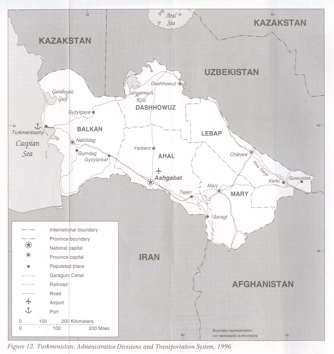
- Administrative Divisions and Transportation System of Turkmenistan - From 1996.
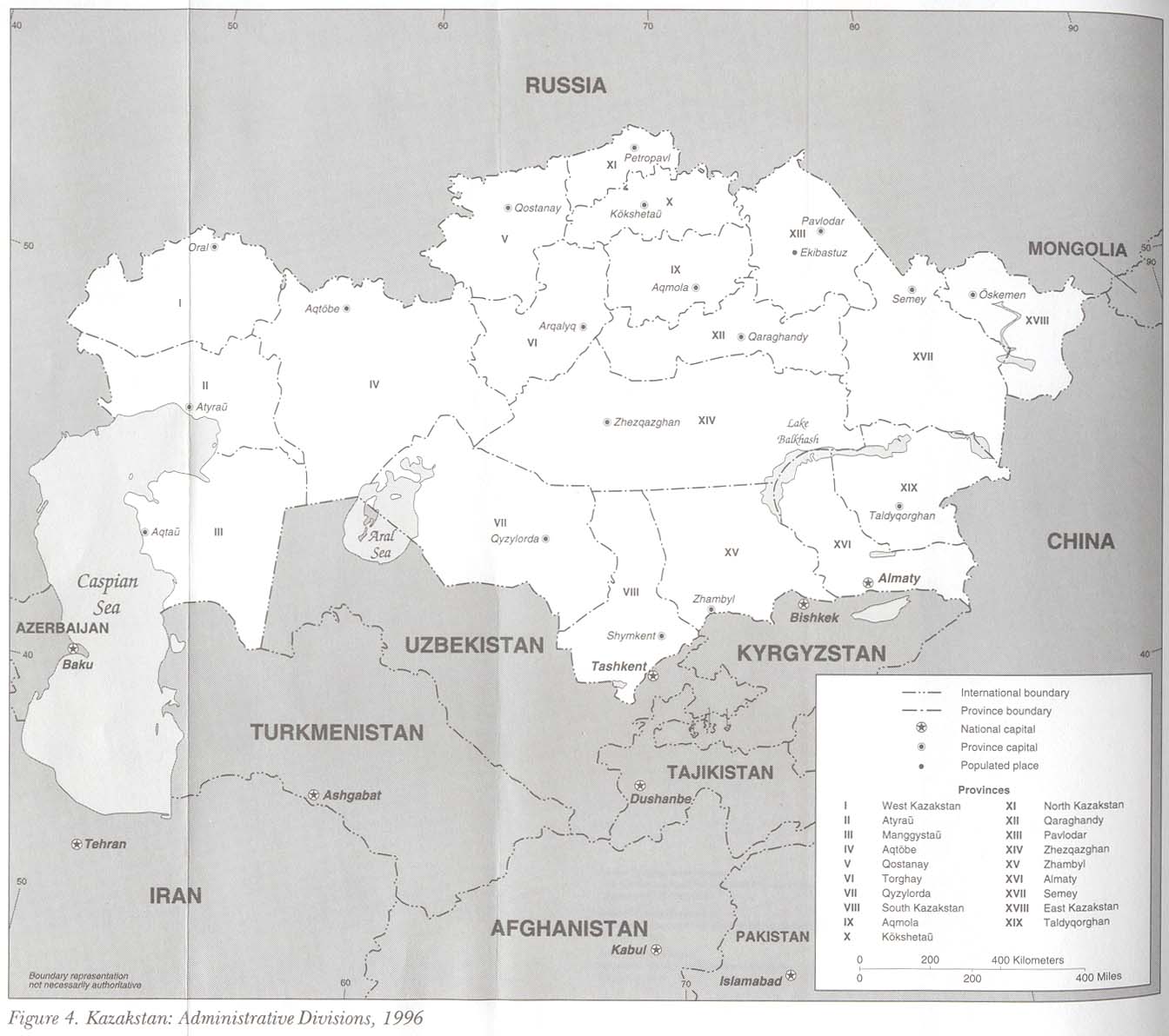
- Administrative Divisions of Kazakhstan - From 1996.
- Aerial Photographs of Colorado - Provides access to over 1,700 digitized aerial photos of Colorado taken by the U.S. Forest Service from 1938 to 1947.
- Afghanistan Map [www.lib.utexas.edu] - Provinces, several cities, bordering countries, and major roads and railway lines.
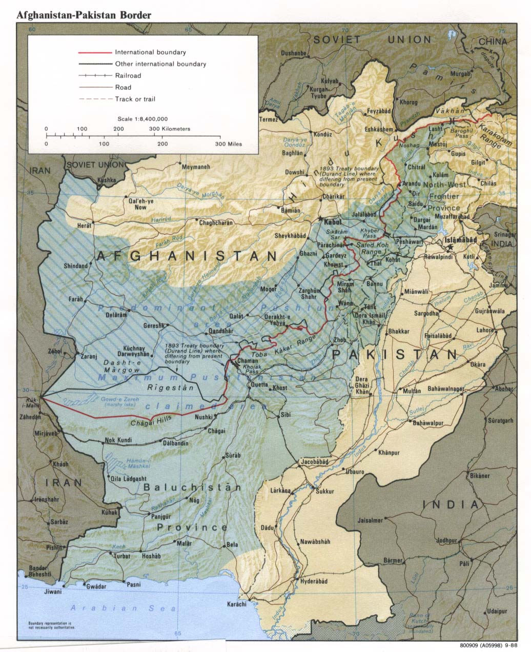
- Afghanistan-Pakistan Border Map - Focussing on the Pushtunistan region shared by both countries.
- Africa Guide - Map of Africa - Includes an interactive map of Africa and an individual map for each country.
- African Studies: Maps of Africa - Offers historical, contemporany, and interative maps of Africa.
- Africana Library: Map of Africa - Interactive map about Africa, and facts about African countries.
- Alabama Maps - Archive of historical Alabama maps as well as maps bases on agriculture, climate, housing, and recreation.
- Alabama State Maps -
- All Topo Maps - Selling topographical maps of Utah on CD-ROM.
- American Adventures Association - AAA produces high quality recreational maps specifically for fly fishing, camping, hunting and the great outdoors.
- Anamosa State Penitentiary - Chronicles the history of the 129-year old maximum security Iowa prison.
- Arab Gateway: Maps of Iraq - Offers several general and detailed maps, including maps of Northern Iraq, Baghdad, military maps, and agricultural and land use maps.
- Arctic Environmental Atlas - Presents environmental variables and parameters on the environment in the Arctic region.
- Arctic Monitoring and Assessment Programme: Maps and Graphics - Searchable maps and graphics database with downloadable images, most pertaining to contamination of the Arctic.
- Arizona National Parks and Tourist Guide - Interactive map of the state providing park information.
- Arkansas Base Map - JPEG format version of the Arkansas state map created by the U.S. Geological Survey in 1990.
- Arkansas Counties Map - Map of Arkansas state counties, including major cities.
- Arkansas Digital Map Library - Historical maps of the state of Arkansas, including 19th century maps, county maps, and maps of the Southern U.S.
- Arkansas Federal Land and Indian Reservations - PDF format map of federal land and Indian reservations in the state of Arkansas.
- Arkansas Interactive Map Viewer - Interactive map of Arkansas, showing major roads, scenic routes, waterways, parks, cities, and topography. From the Arkansas Department of Parks and Tourism.
- Arkansas Map Server - Interactive map server lets you create customized maps of Arkansas using city, county, census, traffic, and other data. From the Arkansas Small Business Development Center.
- Arkansas Maps -
- Armadillo's Texas Maps - Collection of thematic Texas maps including the geographic distribution of Native Americans in the state, land use, population density, and average rainfall.
- Asiamaya.com: Indonesia - Interactive map of Indonesia displaying major cities, provinces, and islands.
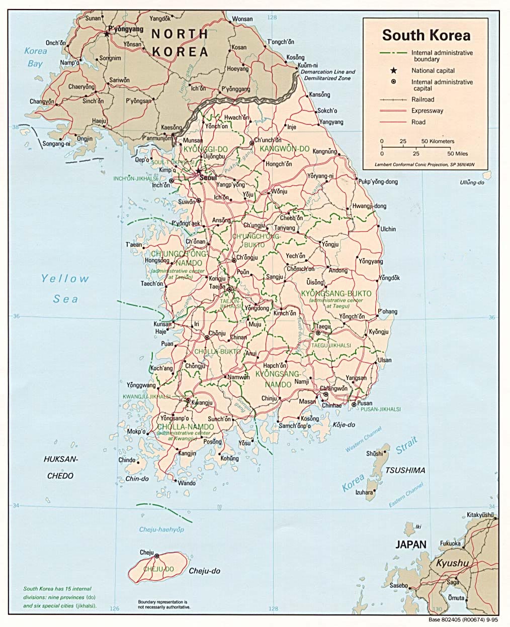
- Asianinfo.org: South Korea - Country map with administrative boundary, railroads, expressways, and roads.
- AskAsia Map & Timeline Library - Offers a collection of political and elevation map of the continent and individual countries.
- AskCity - View maps and local business listings by name, key word, or location, or save your favorite searches. From Ask.com.
- Atlanta Roadways Digest - Real-life, unedited photos of Atlantans at their driving worst.
- Atlapedia - Contains physical and political maps, plus facts and statistics on the countries of the world.
- Atlapedia Online: Germany - Physical and political map of Germany and a description of the country.
- Atlapedia Online: Hungary and Romania - Physical and politicals maps.
- Atlapedia Online: North Korea, South Korea - Political map.
- Atlapedia Online: Spain - Presents political and physical maps of Spain, as well as facts about the country's history, languages, economy, and geography.
- Atlas of Injury Death in Australia 1990-1992 - Provides an insight into the overall incidence of injury.
- Atlas of Mortality in Europe, The - Gives data on regions within countries and shows changes in mortality at this level between 1980/1981 and 1990/1991.
- Atlas of Oregon - Features history, demographic patterns, roadways, land use, and wildlife habitat.
- Atlas of the Orient - Morocco - Interactive map of the country.
- Atlas: Caribbean - Offers a map of the countries, territories, and dependencies in the Caribbean region.
- Avacha Bay Co. - Specializes in current topo maps, guide books, and documentary videos for Russia's Kamchatka Peninsula with international shipping available.
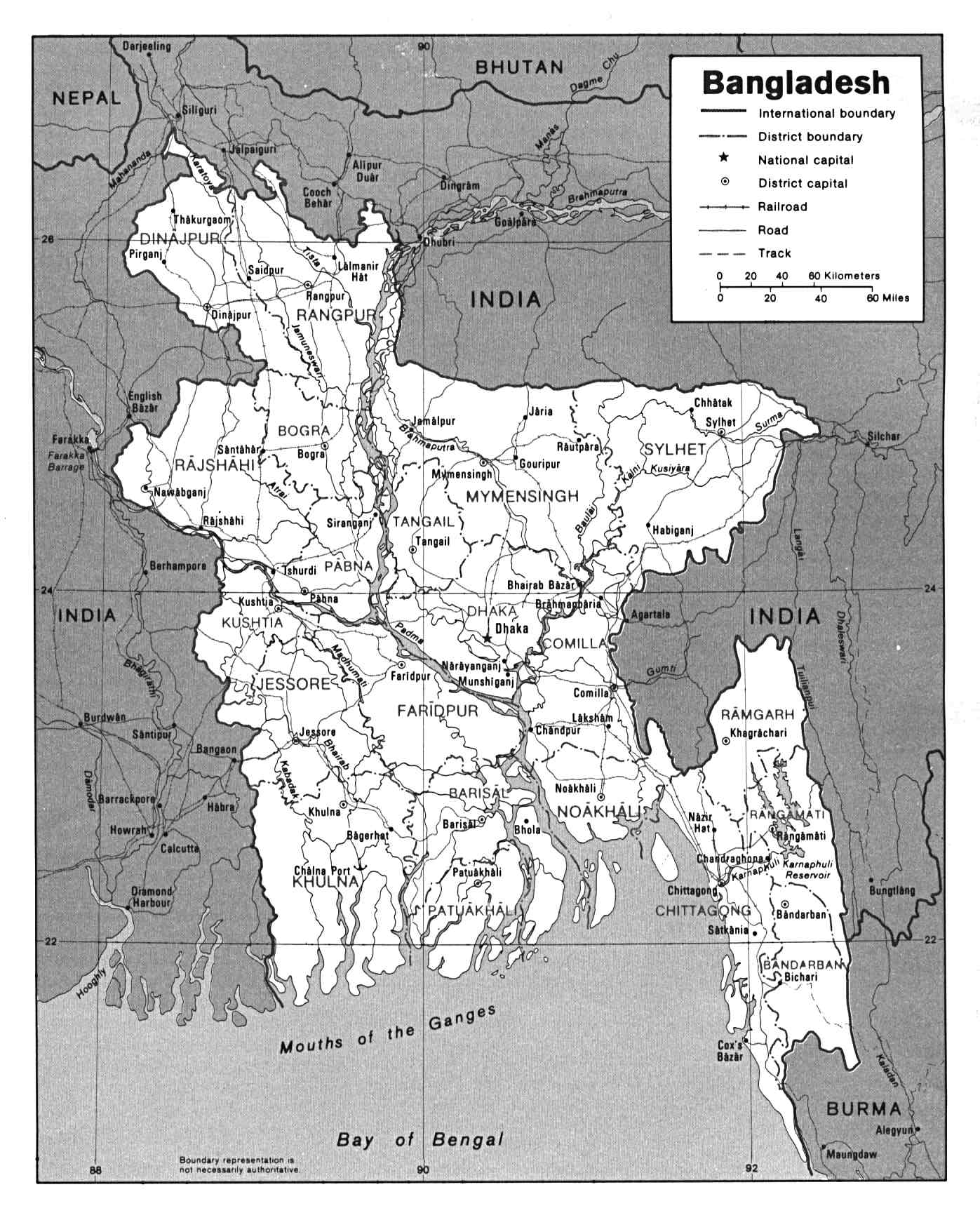
- Bangladesh Map - Large map.
- BBC News: Iraq Key Maps - Features several interactive maps, including Baghdad, Iraqi oilfields, weapons sites, and Presidental palaces.
- BBC News: Israel at Fifty - Features a map of the country and its surrounding nations.
- Beringian Paleoenvironmental Atlas - Provides historical and geologic information on past climates and environments in this region of northwestern North America and northeastern Asia.
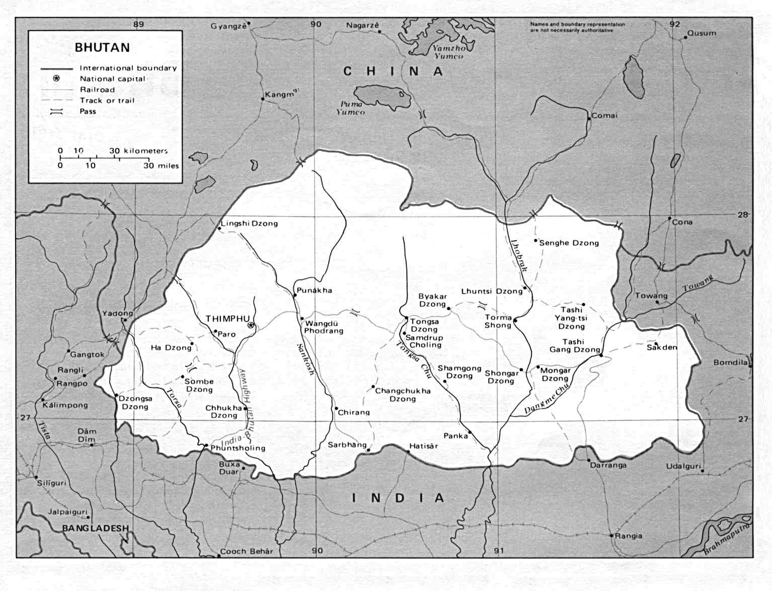
- Bhutan Map - Features large map.
- Big Island Hawaii Pictures - Photographs and postcards of the Big Island of Hawaii.
- Big Italy Map - Provides interactive maps of Italy and several Italian cities and regions.
- Big Ten, Inc. - Maps for gold prospecting, gold panning, mining, treasure hunting, rockhounding and recreation.
- Bill Strong's Eclectic Mississippi Photo Tour - South Mississippi amateur photographer's personal, on-going, primarily black and white exhibit.
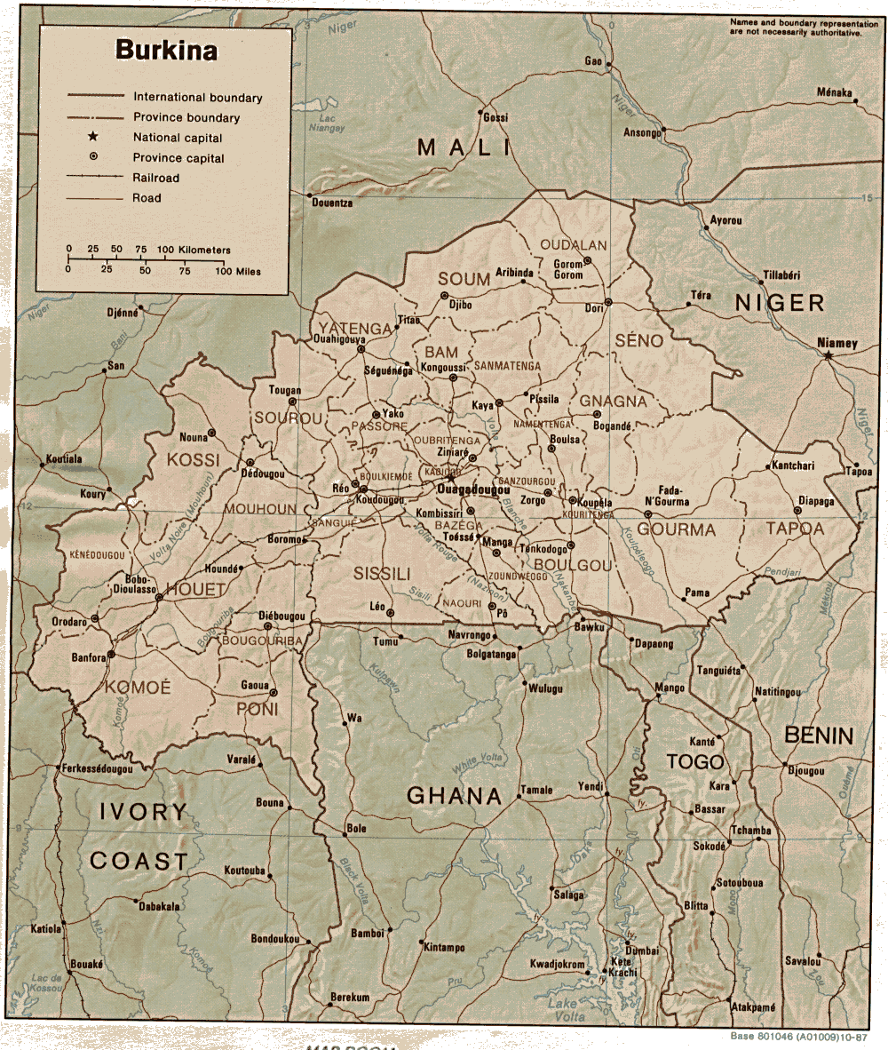
- Burkina - Large country map.
Number of pages: [ 1 2 3 4 5 6 7 8 9 10 11 12 Next > ]
You can find at Asmat.eu


![Afghanistan Map [www.lib.utexas.edu]](http://www.lib.utexas.edu/maps/middle_east_and_asia/afghanistan_pol_93.jpg)